All posts by Neetu Singh

Write note on Project Elephant.

Elephant  is the largest terrestrial mammal of India . Elephant being wide ranging animal requires large areas. The requirement of food and water for elephants are very high and therefore their population can be supported only by forests that are under optimal conditions. The status of elephant can be the best indicator of the status of the forests. About 60% of the Asian elephant population is in India. However current distribution of wild elephant in India is confined to South India; North East including North West Bengal; Central Indian states of Orissa , South WB and Jharkhand; and North West India in Uttarakahnd and UP.

Project Elephant (PE) was launched by the Government of India in the year 1992 as a Centrally Sponsored Scheme with following objectives :

  1. To protect elephants, their habitat & corridors
  2. To address issues of man-animal conflict
  3. Welfare of captive elephants
    • Global Stronghold: India is home to over 60% of the world’s wild Asian elephant population. It was officially declared India’s National Heritage Animal in 2010.
    • Ecological Indicators: Because elephants require massive amounts of daily food and water, their survival relies on thriving, optimal forest ecosystems. Healthy elephant numbers directly indicate a healthy forest.
    • Geographic Distribution: Wild populations are confined to four major fragmented landscapes:
      • South India: Strongest populations, focused along the Western Ghats (Karnataka, Kerala, Tamil Nadu, Andhra Pradesh).
      • North-East India: Heavy concentrations in Assam, Arunachal Pradesh, Meghalaya, and Northern West Bengal.
      • Central India: Highly fragmented groups moving through Odisha, Jharkhand, Southern West Bengal, and Chhattisgarh.
      • North-West India: Located in the Terai and Shivalik foothills of Uttarakhand and Uttar Pradesh.

Project Elephant (Launched 1992)

Project Elephant is a Centrally Sponsored Scheme providing financial and technical backing to major elephant-bearing states.

Core Objectives:

    1. Habitat & Corridor Protection: Securing pristine forest habitats and the narrow migration pathways (corridors) elephants use to travel between them.
    2. Conflict Mitigation: Resolving and managing the socio-economic issues surrounding human-elephant conflict (HEC).
    3. Captive Welfare: Monitoring and ensuring the humane treatment of domesticated/captive elephants.

📊 Census Update: While traditional visual counts previously estimated around 29,964 elephants, India recently launched its first scientific, DNA-based elephant census. This has established a highly precise, reliable modern baseline of 22,446 wild elephants—with Karnataka leading as the state with the highest population.

 Elephant Reserves (ERs) in India

While your notes mention 28 reserves, intense conservation scaling has expanded this network significantly. India now boasts 33 officially notified Elephant Reserves protecting over 80,000 sq. km of forest.

Metric Reserve Details
Total Notified Reserves 33 (Across 14 states)
First Ever Reserve Singhbhum ER in Jharkhand (Notified in 2001)
Latest Reserve Added Terai ER in Uttar Pradesh (33rd Reserve, notified late 2022)
Largest Area Singhbhum ER (Jharkhand) — ~13,440 sq. km
Smallest Area Singphan ER (Nagaland) — ~23.5 sq. km
Highest Frequency Assam and Tamil Nadu share the lead with 5 reserves each

Note: The Dandeli ER (Karnataka) and Khasi Hills ER (Meghalaya) mentioned in your text as “pending” have since been formally notified and integrated into the official list.

The MIKE Program (Monitoring of Illegal Killing of Elephants)

Mandated globally by the CITES Conference of Parties, the MIKE program was established in South Asia in 2003. It collects monthly patrol logs to map poaching patterns, understand the driving forces behind illegal trade, and give local rangers better data for enforcement. The Sub-Regional Support Office in New Delhi oversees India’s sites.

There are 10 designated MIKE Sites across India:

  1. Chirang-Ripu (Assam)
  2. Dihing Patkai (Spelled “Dhang Patki” in earlier drafts) (Assam)
  3. Eastern Dooars (West Bengal)
  4. Deomali (Arunachal Pradesh)
  5. Garo Hills (Meghalaya)
  6. Mayurbhanj (Odisha)
  7. Mysore (Karnataka)
  8. Nilgiri (Tamil Nadu)
  9. Shivalik (Uttarakhand)
  10. Wayanad (Kerala)

Are you organizing these notes to study for a specific competitive exam, or is there a particular regional landscape or elephant corridor issue you would like to explore deeper?


What are the controls of Indian Climate?

Ans. India’s climate is controlled by a number of factors which can be broadly divided into two groups — factors related to location and relief, and factors related to air pressure and winds.

Latitude: Northern part of the India lies in sub-tropical and temperate zone and the part lying south of the Tropic of Cancer falls in the tropical zone. The tropical zone, being nearer to the equator, experiences high temperatures throughout the year with small daily and annual range of temperature. The area north of the Tropic of Cancer which is away from the equator, experiences extreme climate with high daily and annual range of temperature.

The Himalayan Mountains: The lofty Himalayas in the north along with its extensions act as an effective climatic divide. The towering mountain chain provides an invincible shield to protect the subcontinent from the cold northern winds. These cold and chilly winds originate near the Arctic circle and blow across central and eastern Asia. The Himalayas also trap the monsoon winds, forcing them to shed their moisture within the subcontinent.

Distribution of Land and Water: India is flanked by the Indian Ocean on three sides in the south and girdled by a high and continuous mountain-wall in the north. As compared to the landmass, water heats up or cools down slowly creating different air pressure zones in different seasons in and around the Indian subcontinent. Difference in air pressure causes reversal in the direction of monsoon winds.

Distance from the Sea:  With a long coastline, large coastal areas have an equable climate. Areas in the interior of India are far away from the moderating influence of the sea. The seasonal contrasts in weather at places in the interior of the country such as Delhi, Kanpur and Amritsar affect the entire sphere of life.

Altitude: Temperature decreases with height. Due to thin air, places in the mountains are cooler than places on the plains. For example, Agra and Darjeeling are located on the same latitude, but temperature of January in Agra is 16°C whereas it is only 4°C in Darjeeling.


Relief: The physiographic or relief of India also affects the temperature, air pressure, direction and speed of wind and the amount and distribution of rainfall. The windward sides of Western Ghats and Assam receive high rainfall during June-September whereas the southern plateau remains dry due to its leeward situation along the Western Ghats.

The differences in local climates of India, is caused by the mechanism of the following three factors:

  • Distribution of air pressure and winds on the surface of the earth.
  • Upper air circulation caused by factors controlling global weather and the inflow of different air masses and jet streams.
  • Inflow of western cyclones generally known as disturbances during the winter season and tropical depressions during the south-west monsoon period into India, creating weather conditions favorable to rainfall.

On the basis of isoglosses outline cultural regions of world.

On the basis of isoglosses outline cultural regions of world.

Ans. Language is an organized system of spoken words by which people communicate with each other with mutual comprehension. Languages differ greatly in their relative importance, if ‘importance’ can be taken to mean the number of people using them. More than half of the world’s 5 billion inhabitants are speakers of just eight of its thousands of tongues. At the other end of the scale are a number of rapidly declining languages whose speakers number in the hundreds or, at most, the few thousands.

The diversity of languages is simplified when we recognize among them related families. A language family is a group of languages descended from a single, earlier tongue. By varying estimates, from at least 30 to perhaps 100 such families of languages are found worldwide. The families, in turn, may be subdivided into subfamilies, branches, or groups of more closely related tongues.

Family relationship between languages can be recognized through similarities in their vocabulary and grammar. By tracing back through time regularities of sound changes in different languages, linguists are able to reconstruct earlier forms of words and, eventually, determine a word’s original form before it underwent alteration and divergence. Such a reconstructed earlier form is said to belong to a protolanguage.

The distinction between a language and a dialect is not based on an objective measure of mutual intelligibility. Instead we must recognize that language is a function of society’s view of what constitutes a cultural community – a matter that in turn is influenced by historical developments in the political arena. The ability of the Chinese political elite to build and sustain a state encompassing speakers of different, albeit closely related Sino-Tibetan tongues helps explain Chinese as one language. By contrast, the disintegrating of the Danish and Swedish empires is partly responsible for our tendency to recognize several distinct languages in Scandinavia. Under the circumstances, the actual number of languages in use remains a matter of debate. Languages are ground in language families and are thought to have a shared (fairly distant) origin, in a language sub-family, their commonality is more definite. Sub-families are divided into language groups which consist of set of individual languages.

On the map world, there are 12 major language families spatially though Indo European languages are the most widely dispersed family. This family dominates not only in Europe but also in much of Asia, North-South America, Australia and parts of Southern Africa. This family language is spoken by about half of the world’s people with English the most widely used Indo European language.

Geolinguists theorize that a lost language – Proto Indo European existed somewhere in the vicinity of the Black Sea and that the present languages of Indo-European family evolved from it. As Indo-European speakers dispersed, vocabularies grew and linguistic differentiation took place. Latin arose during this early period and was disseminated over much of Europe during the rise of Roman Empire. Later Latin died out and was supplanted by Italian, French and the other Romance languages.

The Major World languages

Although more of the world’s people speak Indo-European languages than languages in any other family, Chinese is the single most important language in terms of number of speaker with English ranking second. The number of speakers in each family is always taken as approximation. As for example, English is not only spoken by North Americans, Britons, Irish Australians and New Zealanders and millions in smaller population countries but it is also used as a second language in India, Africa and elsewhere. The regional languages of India (Indo European as well as Dravidian) are among the most used, but exact data on number of speakers are not available. In case of Africa, none of the languages spoken, South of Sahara is recognized as major world language. The reasons sorted reveal that African language map is highly fragmented. Sub Sahara area still has relatively smaller population, but more than 1000 languages are spoken here. These languages are grouped in four families – Niger-Congo, Saharan, Sudanic and Khoisan. In terms of number of speakers, Hausa is estimated to be most important sub Saharan African language. Hundreds of African languages have fewer than one million speakers. Among the other language families that are spoken by dwindling, often marginally located or island groups. Austro Asiatic languages, spoken in the interiors locales of eastern India and in Cambodia and Laos, are thought to be survivors of ancient languages spoken before modern invasion and cultural diffusion took place. Khmer and Vietnamese are placed in this family. The Papuan and indigenous Australian languages though numerous and quite diverse are spoken by fewer than 10 million people. The languages of Native Americans remain strong only in areas of Middle America, the high Andes and northern Canada. Languages of the Eskimo-Aleut family survive on the Arctic margins of Greenland, North America and eastern Asia.

The map of world languages avails some of the interesting facts. As for example, the island of Madagascar off the East African Coast has Malagasy language as the prime language spoken. This belongs to Malay-Polynesian family, the language of Indonesia and its neighbours. The language map of Europe clearly shows that the Indo European language family prevails in this region, with pockets of Ural Altaic family occurring in Finland and adjacent areas, Hungary and Turkey, west of sea of Marmora. Sub families include the Germanic languages (English, German, Danish, Norwegian and Swedish) Romance languages (French, Spanish, Italian, Romanian and Portuguese), the Slavic languages (Russian, Polish, Czech,

Slovak, Ukrainian Slovenian, Serbo Croatian and Bulgarian) and the Celtic languages. Languages groups in Europe are represented by clusters. Though there is strong correlation between the language spoken and the political organization of space, there are some important exceptions. The French linguistic region extends to Belgium, Switzerland and Italy, but in France itself it co-exists with Celtic tongue in Brittany Peninsula. The use of Romanian extends well into Moldavia, Greek and Albania.

Although the overwhelming majority of Europeans and Russians speak Indo European languages, Ural Altaic language family also represents this realm. Finnish, Estonian and Hungarian are major languages of this family. African language map reveals families, the largest of which is the Niger Congo family which extends from West Africa to central-South Africa. This family can be sub-divided into five sub families. One of these is Bantu sub family whose languages are spoken by most of the people near equator and south of it. Atlantic, Voltaic, Guinea and Hausa are the other subfamilies, mostly spoken in West Africa. The oldest languages of sub Saharan Africa are Khoisan languages (san spoken by only a few thousand people in south West Africa). Perhaps, the Khoisan languages were once the main language of much of Africa, but they have been reduced to comparative insignificant by Bantu invasion. This also justifies the relation of Bantu with other subfamilies.

Critically examine the theories of Industrial location

Critically examine the theories of industrial location

Ans. In understanding present-day industrial locational decisions, three fundamental approaches to the problem of plant location proposed are considered – least cost theory, locational interdependence theory, and profit-maximization approaches – and the different conclusions they reach.

Least-Cost Theory

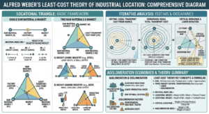
The classical model of industrial location theory, the least-cost theory, is based on the work of Alfred Weber (1868-1958) and sometimes called Weberian analysis. It explains the optimum location of a manufacturing establishment in terms of minimization of three basic expenses: relative transport costs, labor costs, and agglomeration costs. Agglomeration refers to the clustering of productive activities and people for mutual advantage. Such clustering can produce “agglomeration economies” through shared facilities and services. Diseconomies such as higher rents or wage levels resulting from competition for these resources may also occur. Weber concluded that transport costs are the major consideration determining location. That is, the optimum location will be found where the costs of transporting raw materials to the factory and finished goods to the market are at their lowest. He noted, however, if variations in labor or agglomeration costs are sufficiently great, a location determined solely on the basis of transportation costs may not in fact be the optimum one. Weber made five controlling assumptions:

(1) An area is completely uniform physically, politically, culturally, and technologically. This is known as the uniform, or isotropic, plain assumption.

(2) Manufacturing involves a single product to be shipped to a single market whose location is known.

(3) Inputs involve raw materials from more than one known source location.

(4) Labour is infinitely available but immobile in location.

(5) Transportation routes are not fixed but connect origin and destination by the shortest path; and transport costs directly reflect the weight of items shipped and the distance they are

moved.https://www.youtube.com/channel/UCINzglszT5_M6AVYkoWfkLQ?view_as=subscriber

Given these assumptions, Weber derived the least transport cost location by means of the locational triangle. It diagrams the cost consequences of fixed locations of materials and market and of movement in any direction of a given weight of commodity at a uniform cost per unit of distance. Weberian analysis, however, aims at the least transport cost location, which most likely will be an intermediate point somewhere within the locational triangle. Its exact position will depend on distances, the respective weights of the raw material inputs, and the final weight of the finished product, and may be either material or market oriented. Material orientation reflects a sizeable weight loss during the production process; market orientation indicates a weight gain.

Locational Interdependence Theory

When the locational decision of one firm is influenced by locations chosen by its competitors, a condition of locational interdependence exists. It influences the manner in which competitive firms with identical cost structures arrange themselves in space to assure themselves a measure of spatial monopoly in their combined market. In locational interdependence theory, the concern is with variable revenue analysis rather than, as in the Weber model, with variable costs. The simplest case concerns the locational decisions of two firms in competition with each other to supply identical goods to customers evenly spaced along a linear market. The economist Harold Hotelling (1895-1973), who is usually associated with the locational interdependence approach, expanded the conclusion about clustered ice cream sellers to a more generalized statement explaining industrial concentration by multiple producers under conditions of identical production costs and inelastic market demand. However, if the market becomes sensitive to price, sales to more distant customers will be discouraged and producers seeking to maximize sales will again separate rather than aggregate. The conclusion then is that price sensitivity (elasticity of demand) will encourage industrial dispersion.

Profit-Maximization Approaches

For many theorists, the simplicities and rigidities of the least-cost and the locational interdependence explanations are unrealistically restrictive. Ultimately, they maintain, the correct location of a production facility is where the net profit is greatest. They propose employing a substitution principle that recognizes that in many industrial processes, it is possible to replace a declining amount of one input (e.g. labor) with an increase in another (e.g. capital for automated equipment) or to increase transportation costs while simultaneously reducing land rent. With substitution, a number of different points may be appropriate manufacturing locations. Further, they suggest, a whole series of points may exist where total revenue of an enterprise just equals its total cost of producing a given output. These points, connected, mark the spatial margin of profitability and define the larger area within which profitable operation is possible. Location anywhere within the margin assures some profit and tolerates both imperfect knowledge and personal (rather than economic) considerations. Such less-than-optimal, but still acceptable, sites are considered satisficing locations.

For some firms, spatial margins may be very broad because transport costs are a negligible factor in production and marketing. Such firms are said to be footloose – that is, neither resource nor market oriented. For example, both the raw materials and the finished product in the manufacture of computers are so valuable, light, and compact that transportation costs have little bearing on where production takes place. Other Locational Considerations and Controls : The behavior of individual firms seeking specific production sites under competitive commercial conditions forms the basis of most classical industrial location theory. But such theory no longer fully explains world or regional patterns of industrial localization or specialization. Moreover, it does not account for locational behavior that is uncontrolled by objective “factors,” influenced by new production technologies and corporate structures, or directed by noncapitalistic planning goals.

Traditional theories (including many variants not reviewed here) sought to explain location decisions for plants engaged in mass production for mass markets where transportation lines were fixed and transport costs relatively high. Both conditions began to change significantly during the last years of the 20th century. Assembly line production of identical commodities by a rigidly controlled and specialized labor force for generalized mass markets – known as “Fordism” to recognize Henry Ford’s pioneering development of the system – became less realistic in both market and technology terms. In its place, post-Fordist flexible manufacturing processes based on smaller production runs of a greater variety of goods aimed at smaller, niche markets than were catered to by traditional manufacturing have become common. At the same time, information technology applied to machines and operations, increasing flexibility of labor, and declining costs for transportation services that were increasingly viewed from a cost-time rather than a cost-distance standpoint have materially altered underlying assumptions of the classical theories.

Write short notes on the Realism

Realism is a posture that assumes the constitutive autonomy of different phenomena in relation to our ability to understand them, and the reliability of our understanding in apprehending them correctly. Realism can be ontological (relating to a fundamental belief that cannot be demonstrated) or epistemological (and as such considered to be the only correct manner of scientific undertakings: confronting things as they exist, independently from our own volition). This means that realism requires a degree of confidence in the reliability of our openings onto the world (our sensory experience, report by others, scientific measures). Thus positivism can be said to be a form of realism that casts doubt on immediate experience and our spontaneous categorisations, tending to integrate these into protocols that aim to extract explicative relationships or laws from reality, these being the only objects worthy of being targeted by science.

Realism is the view that reality exists independent of the mind; it is not mind dependent. It is antithetical in many respects to idealism. Gibson suggests realism as a viable alternative explanation to idealism. The basic philosophy of realism is that facts speak for themselves and explanation is logical and inductive. Realism advocates the use of theories and models in geographical explanation. It is very close to the objective philosophy of positivism but has different methodology of explanation.

Historically, realism by the Platonic-Socratic thought was used in opposition to nominalism” for the doctrine that universal and abstract entities have real objective existence. At present, it is, however, used in opposition to idealism. In contrast to other philosophies of science such as naturalism, positivism, and idealism, realism is based on the doctrine that human science is an empirically-based rational enterprise which explains observable regularities by describing the hidden, but ‘real’ structures that casually generate them.

In his theory of ideas, Plato asserted that the forms we see, touch, taste and smell in time and space do not exist and are not knowable with our senses. A particular phenomenon is only appearance which shall disappear in due course of time.

For example, a specific mountain like the Himalayas does not exist, it will be worn down to the ocean floor over geological time. Contrary to this, the general and universal term ‘mountain’ is rigid and fixed. Just opposite to it, the nominalists, notably, Aristotelians denied the existence of an ideal mountain. For the early nominalists ‘mountain’ was a mere term. What is real is a particular mountain that we can all see and touch.

The battle between the realists and nominalists over the existence of abstract entities of problematic entities, carried over the medieval period. During the medieval period, the Platonic-Socratic thought came to be known as scholastic realism. The main proponent of scholastic realism was John Scot.

In the 19th century, ‘realism’ took the shape of ‘direct’ or ‘naive’ realism which was a polemic against idealism. Cook Wilson was the founder of ‘naive realism’. He and his pupils denied the existence of any problematic or abstract entity—a denial which of course runs counter to Plato. For direct realist:

Nothing existed that was not observable in time and space. From this ontology they developed a logic of perceiving the world, a common-sense logic which argued that our views of the world are constructed in the mind by an interaction, through society, with the physical world.

This direct naive realism has had a sustaining influence on geography, especially on commercial and military geography, since the Victorian period. For the naive or common-sense geographers, the mind grasps the world in a simple effortless process, something we do all the time.

Geographical facts of observed phenomena and changes within them can be objectively established and any question of unseen entities, problematic, abstract forms or subjective impressions is irrelevant. With due precautions, by simple common-sense, we can know the reality of a place, as the topography looks, as the soil feels, as the water tastes, etc. The objectives of ‘naive realism’ are common to those social reform to or national surveys. Stamp, with this objective, conducted the land use survey of Britain and suggested significant changes in the utilization of land.

It gave more job opportunities and greater respectability to geographers. The sixties can be called as a period of extreme of naive realism, which has also been termed as a phase of ‘quantitative revolution’ in geography. This revolution was based mainly on a move toward philosophical ‘positivism’.

Realism has taken the shape of ‘new or critical realism’ in the last few decades. It was propounded by T.P. Nunn. The essence of the concept of new realism is that anything we experience depends for its existence upon the fact that it is experienced. In other words, the objects of our perception are actual properties of the physical world. The proponents of this philosophy asserted that nothing exists excepting that which is experienced.

What is radical approach in Geography? | Human Geography

 What is radical approach in Geography?

Ans. The radical approach in geography developed in 1970s as a reaction to ‘quantitative revolution’ and positivism which tried to make geography as a spatial science, with great emphasis on locational analysis.

The followers of radical approach in geography mainly concentrated on the issues of great social relevance like, inequality, racism, sexism, crime, delinquency, discrimination against blacks and non-whites, females, exploitation of juveniles and environment resources and the opposition of the Vietnam war in U.S.A. Events of the late 1960s, such as the burning of large cities in the western world, student-unrest, worker-uprising in Paris in 1968, massive anti-Vietnam war protest actions and radical cultural reformation exposed the social and political irrelevance of geography as a spatial science and proved the hollowness of locational analysis.

It was in this background that the radicalized students and junior faculty members challenged the traditional geography (geography as spatial science) and they started publishing articles with more ‘socially relevant’ geographic topics in the professional journals. In 1969, Antipode—a Radical Journal of Geography was founded at the Clark University in Worcester (Massachusetts), specifically to publish the research papers of the younger geographers with a revolutionary leaning.

The young radical geographers published papers in Antipode dealing with urban poverty, discrimination against women, colored people and minority groups, unequal access to social amenities, crimes, deprivation, permissiveness and sexism. They also published articles on underdevelopment, poverty, malnutrition, and unemployment and resource misuse in the Third World countries. Thus, the radicalists took the side of the oppressed, advocating their causes and pressing for fundamental social change. In brief, the radical geography was a quest for social relevance of the discipline geography at a time of contradiction and crises in the capitalistic society of the west.

The origin of the radical geography movement can be traced to the in late 1960s, especially in the U.S.A. with three contemporary political issues: The Vietnam war, Civil rights (especially of the American blacks), and The pervasive poverty and inequality suffered by the residents of urban ghettos and deprived rural areas all of which were generating increased social unrest and tension. In the words of Peet (1977), radical geography developed largely as a negative reaction to the established discipline (spatial science). The radical geographers introduced the study of topics such as poverty, hunger, health, and crime to human geographers, who had previously very largely ignored them.

The salient features and objectives of radical geography were:

  • To expose the issues of inequality, deprivation, discrimination, health, exploitation, crime and environmental degradation in the capitalist countries.
  • To highlight the weaknesses of the positivism and quantitative revolution in geography which emphasized on geography as a ‘spatial science’ with a thrust on locational analysis.
  • To bring a cultural revolution to eradicate permissiveness, sexism and discrimination against females.
  • To remove regional inequalities.
  • Radicalists opposed political centralization and economic concentration. Contrary to multinationals, they favoured small- scale self sufficient social units, living in greater harmony with their natural surroundings.
  • They were against imperialism, nationalism, national chauvinism and racism.
  • They opposed the idea of the superiority of the white and the west.
  • According to radicalists the man and environment relationship may be understood through history. In other words, the mode of production in any society determines the economic relation among its people.
  • One of the objectives of the radicalists was to explain not only what is happening but also to prescribe revolutionary changes and solution to the social problems.

Best Optional Geography Coaching for IAS : How to decide the best institute for UPSC

Choosing the right optional coaching is one of the most critical decisions in your UPSC journey, especially for a vast and semi-scientific subject like Geography. Neetu Singh Ma’am (Direction IAS) is undeniably one of the most respected and established names in this field.

To help you decide if her institute is the best fit for you, let’s break down the general framework for choosing a Geography institute, followed by an objective look at her teaching style, strengths, and areas where you might need caution.

The 4-Pillar Framework to Decide on a Geography Institute

Before committing your time and money to any coaching center, evaluate them against these four criteria:

  1. Pedagogy (Teaching Style): Does the teacher explain complex concepts (like geomorphology or climatology) from scratch, or do they assume you already have a geography background?

  2. Syllabus Coverage: Is the entire syllabus completed systematically? Pay close attention to Paper 2 (Indian Geography), which needs constant integration with current affairs.

  3. Answer Writing & Evaluation: Does the core faculty evaluate your answers and provide personal feedback, or is it outsourced to a team of content writers?

  4. Study Material: Are the class notes comprehensive enough to replace heavy textbooks, or will you still have to juggle multiple references?

Deep Dive: Neetu Singh Ma’am (Direction IAS)

Neetu Singh Ma’am has been mentoring civil services aspirants for over two decades. Her institute, Direction IAS, focuses heavily on a disciplined, comprehensive approach.

The Pros (Why Aspirants Choose Her)

  • Single-Faculty Ownership: Unlike institutes where 2–3 different teachers split the syllabus, Ma’am covers 100% of the syllabus herself. This ensures a seamless thematic flow between Physical, Human, and Indian Geography.

  • Exceptional Foundations & Mapping: She is highly praised for building concepts from the absolute ground up. Her command over mapping and physical geography makes it incredibly easy for students—even those from non-science backgrounds—to grasp tough topics.

  • Exhaustive Classroom Dictation: Her methodology involves thoroughly explaining a topic and then dictating detailed notes. For students who struggle with note-making, her classroom dictation acts as a definitive reference.

  • Highly Approachable: Student feedback consistently highlights that she is accessible for doubt-clearing and personal mentorship. She actively reviews answer scripts and guides students on where they are lacking.

The Cons / Things to Keep in Mind

  • Pace and Volume: Because she covers the syllabus comprehensively, the sheer volume of dictated notes can feel overwhelming. Keeping up with her pace in class requires intense focus.

  • Human Geography Analytics: While her foundational lecturing is top-tier, some aspirants note that the highly dynamic sections of Human Geography and contemporary Paper 2 issues require extra effort and current affairs integration from your end.

  • Class Context is Mandatory: Buying her handwritten notes from the market without attending her lectures can be confusing. Her material is designed to complement her verbal explanations, not necessarily to stand alone as a self-study textbook.

Market Comparison: Notable Alternatives

To make an informed choice, it helps to see how she compares with other highly rated Geography faculty in the UPSC ecosystem:

Faculty & Institute Core Strength Teaching Style
Neetu Singh Ma’am  Comprehensive coverage, mapping, foundational clarity, and heavy dictation. Traditional, exhaustive, teacher-led, excellent for beginners wanting structured notes.

2025 UPSC Main- Thought Question

How have dichotomy and dualism affected the methodological development of Geography? Describe.  

Dichotomy and dualism have been both divisive and productive forces in Geography. While they initially led to fragmentation and methodological divides, they also:

  • Encouraged specialization
  • Stimulated debates and paradigm shifts
  • Ultimately pushed the discipline toward integration and methodological pluralism

While dualism and dichotomy often appear together in Geography, they serve different roles. Dualism is philosophical and interpretative, shaping methodological approaches, whereas dichotomy is structural and organizational, helping classify the discipline. Together, they have influenced both the intellectual foundations and the methodological development of Geography.

Overall Influence on Methodological Development

Specialization and Fragmentation Dualisms divided geography into subfields with distinct methods, leading to depth but also fragmentation.

Methodological Innovation Each side of a dichotomy developed its own tools:

Natural science methods (experiments, remote sensing)

Social science methods (surveys, participatory research)

Debate and Intellectual Growth Conflicts between opposing approaches stimulated critical thinking and paradigm shifts.

Major Dualism & Dichotomies with Methodological Impact

  1. a) Physical vs Human Geography This is the most prominent dualism.

Physical Geography focused on natural processes (geomorphology, climatology), adopting methods from natural sciences—observation, measurement, modeling.

Human Geography studied human activities, culture, and society, using social science methods—surveys, interviews, qualitative analysis.

  • Led to specialization and methodological divergence.
  • Created separate research traditions and tools.
  • Later encouraged integrative approaches like environmental geography and sustainability studies.
  1. b) Regional vs Systematic Geography

Regional Geography: Studies specific areas holistically (idiographic approach).

Systematic Geography: Studies particular phenomena globally (nomothetic approach).

  • Regional geography relied on descriptive, field-based, and synthetic methods.
  • Systematic geography promoted analytical, comparative, and theory-building methods.
  • This dichotomy led to debates about whether geography should describe unique places or develop general laws.
  1. c) Determinism vs Possibilism

Environmental Determinism: Environment controls human actions.

Possibilism: Humans have agency and can modify the environment.

  • Determinism encouraged causal, often simplistic environmental explanations.
  • Possibilism introduced more nuanced, human-centered, and interpretative methodologies.
  • Helped shift geography toward social theory and cultural analysis.
  1. d) Quantitative vs Qualitative (Positivist vs Humanistic)

Quantitative/Positivist: Uses statistics, models, spatial analysis (e.g., spatial science revolution).

Qualitative/Humanistic: Focuses on perception, experience, and meaning.

  • The quantitative revolution (1950s–60s) introduced mathematical models, GIS, and hypothesis testing.
  • Reaction to it led to behavioral, radical, and humanistic geographies using interviews, ethnography, and critical theory.
  • Ultimately broadened methodological pluralism.

Today, Geography is best understood as a bridging discipline that synthesizes natural and social sciences, moving beyond rigid dualisms toward a more holistic understanding of space, place, and environment.

  • Emergence of interdisciplinary fields (e.g., human–environment interactions, GIS)
  • Adoption of mixed methods (quantitative + qualitative)

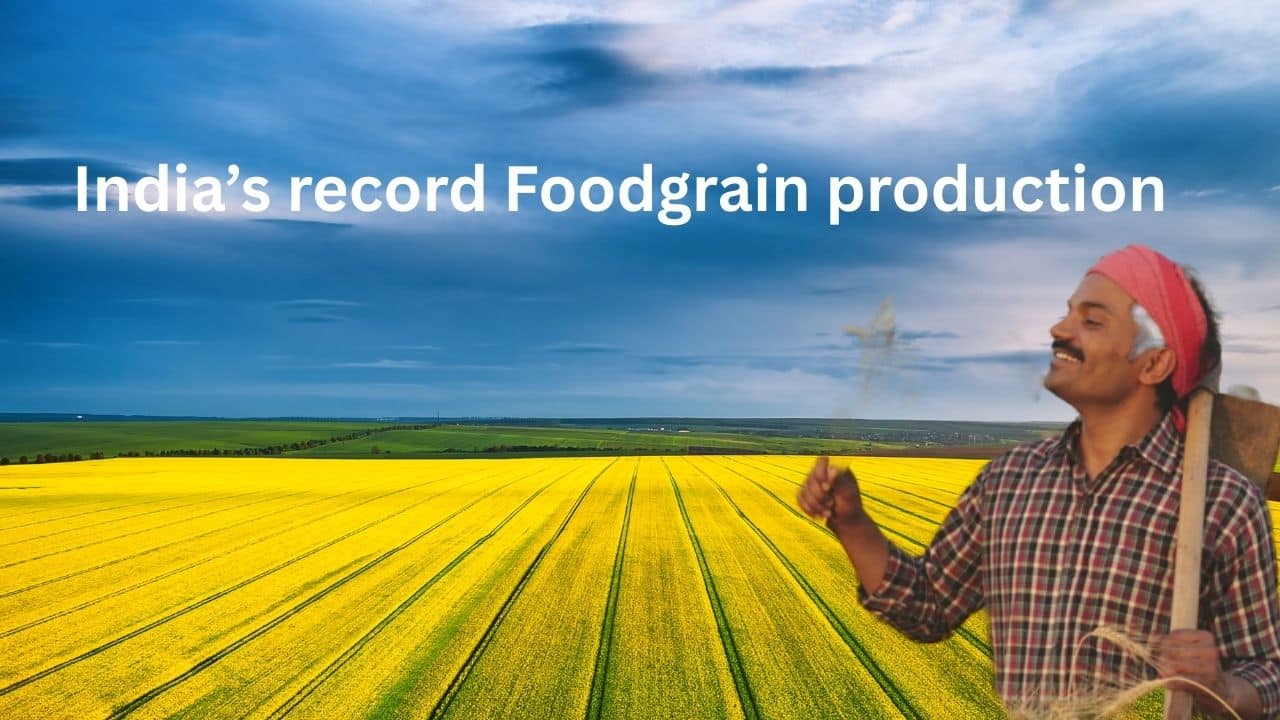
India’s record Foodgrain production

Foodgrain production rises to 357.73 million tonnes in 2024-25, up from 332.30 million tonnes in 2023-24

Agriculture Minister stated that rice production has also reached a record level of 1,501.84 lakh tonnes, which is 123.59 lakh tonnes higher than last year’s 1,378.25 lakh tonnes. Wheat too has registered record growth, rising to 1,179.45 lakh tonnes, an increase of 46.53 lakh tonnes over last year’s 1,132.92 lakh tonnes. Moong production has increased to 42.44 lakh tonnes, soybean to 152.68 lakh tonnes, and groundnut to 119.42 lakh tonnes. Maize and ‘Shri Anna’ (millet) output are estimated at 434.09 lakh tonnes and 185.92 lakh tonnes, respectively, compared to 376.65 lakh tonnes and 175.72 lakh tonnes, respectively, last year.

Expressing satisfaction over the strong rise in oilseed production, the Union Minister said that total oilseed output during 2024-25 is estimated at a record 429.89 lakh tonnes, which is 33.20 lakh tonnes higher than the 396.69 lakh tonnes produced in 2023-24. The increase is driven by record groundnut and soybean output, estimated at 119.42 lakh tonnes and 152.68 lakh tonnes respectively. These represent increases of 17.62 lakh tonnes and 22.06 lakh tonnes over last year’s 101.80 lakh tonnes and 130.62 lakh tonnes. Rapeseed and mustard output is estimated at 126.67 lakh tonnes.

presented crop-wise details as follows:

Total foodgrains – 3,577.32 lakh tonnes (Record)

● Rice – 1,501.84 lakh tonnes (Record)
● Wheat – 1,179.45 lakh tonnes (Record)
● Nutri/Coarse Cereals – 639.21 lakh tonnes
● Maize – 434.09 lakh tonnes
● Total Pulses – 256.83 lakh tonnes
● Shri Anna (millet) – 185.92 lakh tonnes
● Chickpea – 111.14 lakh tonnes
● Moong – 42.44 lakh tonnes
● Tur – 36.24 lakh tonnes
Total Oilseeds – 429.89 lakh tonnes

● Soybean – 152.68 lakh tonnes (Record)
● Groundnut – 119.42 lakh tonnes (Record)
● Rapeseed & Mustard – 126.67 lakh tonnes
Sugarcane – 4,546.11 lakh tonnes
Cotton – 297.24 lakh bales (170 kg each)
Jute and Mesta – 88.02 lakh bales (180 kg each)

Himalaya is a global biodiversity

The Himalaya is a global biodiversity hotspot covering parts of Nepal, Bhutan, China, and India’s Northeast, renowned for its incredible plant and animal diversity, especially endemic species. This region features extreme elevation changes, creating diverse ecosystems from subtropical forests to alpine meadows and is home to threatened species like tigers, snow leopards, and the

Red Panda.

  • Mammals: Home to iconic and endangered species such as Asian Elephants, Tigers, Snow Leopards, and the Red Panda.
  • Birds: Includes the vulnerable Great Hornbill and White-bellied Heron.
  • lants: Hosts an estimated 9,000 plant species, with about 3,500 being endemic and holding medicinal properties.

    The Western Ghats form a part of Western Ghats-Sri Lanka global biodiversity hotspot.

    They run parallel to the west coast of India and run across the states of Maharashtra, Goa, Karnataka, Tamil Nadu and Kerala. Locally they are also known as the Sahyadris.

    Out of the 5584 indigenous species of plants, 2242 species are endemic to India and 1261 are endemic to the Western Ghats endemics.

    The Western Ghats is also rich among the invertebrate groups.

    • About 350 ant species, 20% of which are endemic to this region.
    • 330 butterfly species, 11% of which are endemic to this region.
    • 174 odonate species that includes dragonflies and damselflies, 40% of which are endemic to this region.
    • 269 mollusc species that includes land snails, 76% of which are endemic to this region.
    • The fish fauna of the Western Ghats spans around 288 species, 41% of which are endemic to this region.
    • The amphibian fauna of this region consists of 220 species, of which 78% are endemic.
    • 62% of the 225 described species of reptiles found here, are endemic to this region.

    Over 500 species of birds and 120 species of mammals are also known from this region.

    • Key species: Home to endangered species like the Nilgiri Tahr and Lion-tailed Macaque.

    The Western Ghats region harbours the largest global populations of the Asian elephants and possibly of other mammals such as the tiger, dhole and gaur. Wild relatives of cultivated plants are also found here, including pepper, cardamom, mango, jackfruit and sandal.

    The North-East forms a part of Indo-Burma global biodiversity hotspot.

    Some parts of the north-eastern region of India, excluding the Himalayan region, form a part of the Indo-Burma biodiversity hotspot.

    • It is centred on the Indo-Chinese Peninsula, and comprises of Cambodia, the Lao People’s Democratic Republic, Myanmar, Thailand, Vietnam and parts of Southern China.
    • More than 60% of the bird species found in India have been recorded in the North-East.
    • It harbours 35 endemic reptilian species including two genera of lizards and two turtle species.
    • Out of 341 Indian amphibian species, at least 68 species are known to occur in the North-East. 20 out of the 68 are endemic.
    • It is enriched with 13,500 vascular plant species, of which about 7000 (52%) are endemic to North-East.
    • 74 out of the 1277 bird species found in Indo-Burma are endemic to North-East.
    • 71 of the 430 mammal species in the hotspot are endemic to this region.
    • 189 of the 519 non-marine reptile species are endemic to this region.
    • 139 of the 323 amphibian species are endemic to the hotspot.
    • It also supports a high diversity of freshwater turtles.
    • It also accounts for about 10% of the fish fauna in the world. 566 out of the 1262 documented fish fauna species are endemic to this region.

    Nicobar Islands are a part of the Sundaland global biodiversity hotspot.

    • Mangrove forests are found in these islands.
    • 3500 plant species are found in the Andaman and Nicobar group of islands.
    • Out of these 3500 species, 422 of floral genera and 648 species are endemic to the Nicobar Island.
    • Out of the 120 pteridophyte species of the Andaman and Nicobar Islands, 50% are from Great Nicobar Island alone.
    • A total of 110 wild orchids are reported from these islands, of which 19 genera, with 25 species, are endemic.

    The Malayan box turtle, the Sunbeam snake, the Saltwater crocodile and the Reticulated python are found in the Southern Nicobar group, besides several species of Pit viper in the central Nicobars.

    15 reptile species are reported to be endemic to the Nicobars.

    Four species of marine turtle, the Leatherback turtle, Hawksbill turtle, Green sea turtle and the Olive ridley turtle feed and nest around the Andaman and Nicobars. The nesting population of Leatherbacks in the Nicobars is one of the last four colonies that exceed 1000 individuals in the Indo-Pacific and hence has global significance.

    https://youtu.be/zoXsohPDVZc